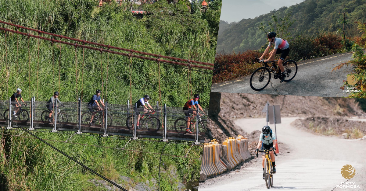
The KOM route (also known as Wuling pass east route) was rated one of the top 10 cycling routes by the cycling media GCN. It is 104 kilometers long, with an elevation gain of 3,275 meters. Basically, the whole journey is all about climbing.
The highlight of the climb is from Dayuling to the last 10 kilometers to the Wuling monument. The slope is hugely challenging, considering riding 90 km at a high altitude where oxygen is scarce. Today, I will break down the world-famous cycling route and introduce how to better concur it.
Route analysis:
The KOM route lengths 104 kilometers, with an elevation of 3400 meters, and consists of Highway 8 and Highway 14A. You will be starting your ride with 90 kilometers of gentle slopes and the last 10 kilometers of extremely brutal slopes. The following is an introduction to the analysis of each section of KOM route:


The route diagram for Taiwan KOM challenge
Qixingtan Beach-Taroko Archway
This is the neutral section for the Taiwan KOM challenge race. It’s all flat in 18km, which makes a good warm-up section with high cadence to prepare your body for the next riding state.


Taroko Archway


Taroko Archway-Tianxiang
After passing the Taroko Archway, you are now entering the climbing section which is moderate compared to the later ones. The slope here is about 2% which feels flat. There are few steep slopes here and there, but most are very short.
You would want to utilize the gentle slopes and keep the speed fast, especially if you are racing. That being said, remind yourself not to ride too hard in this section because there are still dozens of kilometers of climbing ahead. A Great comfort is being surrounded by the majestic Taroko valley along the way and enjoying the canyon view. After 20 kilometers of paddling, you will arrive at Tianxiang, 480 meters above sea level. This is where most tourists visit, and you will also find the only convenience store in the entire section.


Tianxiang 7-11


Tunnel along the way
Tianxiang-Sibao
After Tianxiang, there will be less traffic and vehicles. The section from Tianxiang to Xibao is the steepest section before Dayuling. You will feel an apparent upgrade of the slope as if the game was switched to another level. The length is about 8 kilometers, and the average gradient is 5.5%, which is almost equivalent to the FongGueiZuei climb in Taipei. The advice here is not to rush into a steep slope blindly; you should steadily finish this section at your comfortable pace.
Sibao-Xinbaiyang
In this section, you will be climbing more than 800 meters within 18 kilometers.
Midway, you will find a rest station in Hualuxi (1,380 meters above sea level), which sells hot food and simple meals- just in time for cyclists who have burned some calories, so take a bite before you continue. There is a palm slope on the way to Xinbaiyang, but it is not long. The altitude of Xinbaiyang is 1,644 meters above sea level, which means you are almost there!


Hualuxi rest station


Xinbaiyang
Xinbaiyang-Bliv Divine Tree
Here comes a relax section: 14-kilometers from the Xinbaiyang to Bliv Divine Tree where the gradient becomes relatively gentle at about 3-4%. At this time, you can take it easy and try to recover, adjust your riding rhythm until you reach Bliv Divine Tree where you can get light meals and hot drinks. In addition, the hairpin bend of Bliv Divine Tree is the place with the most photographers in the KOM challenge. So even if you are exhausted, be sure to post your best and smile for the cameras.


hairpin bend of Bliv Divine Tree
Bliv Divine Tree-Guanyuan
After passing Bliv Divine Tree, there are 4.3 kilometers downhill after passing the Bilu tunnel; it could be freezing and windy at this altitude, so remember to put on your jacket to avoid cramps. After descending, climb 2 kilometers to Guanyuan Gas Station. It is the highest gas station in Taiwan, and you can find the must-try delicious meat dumplings nearby.


Guanyuan Gas Station
Guanyuan-Dayuling
From Guanyuan to Dayuling, you will be riding at an altitude of 2,565 meters for about 4.7 kilometers. Dayuling is the junction of Highway 8 and Highway 14A. It is the road to Lishan on one side and Wuling on the other. This means the gentle slope of KOM is coming to an end, leading to the last 10 kilometers of “heaven road”.


Dayuling


Coniferous forest landscape of Dayuling
Dayuling-Wuling
This section belongs to Highway 14A, the last and the most challenging section of the KOM challenge. It is only 10 kilometers long but rises 700 meters of elevation, deducing the 1 kilometer of descent, the actual average gradient exceeds 10%.
After 90 kilometers of devastation, coupled with the impact of high altitude, it would be a big test of willpower. The first half is relatively demanding. The average slope of 5 kilometers to the Xiaofengkou Visitor Center is 8.4%, and there are many steep slopes with dozens of slops. After passing the Xiaofengkou Visitor Center, you face a monster slope of about 600 meters long with an average slope of 13%. The hairpin bend at the 36k sign is the steepest place, which max gradient reaches 27%; it is the point where most cyclists decided to get off their bike.
After this section, the slope at the back will ease slightly all the way to the 1km downhill at the 34k mark, so rest your legs temporarily here. When you finally reach 3158 cafe, the downhill is over, and you are about to take the last 1.5 kilometers challenge with an average slope of 11% and a steep slope close to 20%. At this point, all you can feel is exhaustion, and you can only climb up by gritting your teeth with determination. When you see the Wuling archway, voila! You have completed the KOM route, cycling from 0 to 3275m altitudes in one ride!


Wuling Archway


The mountain view on the top
Precautions
There are very few stores along the whole section of the KOM route; the only convenience store you can find is at Tianxian. In addition, you will be riding through many tunnels in the entire section of Highway 8, most of them are adequately lighted, but there are two you have to solely rely on your own headlight: the Bilu tunnel and the Golden Horse Tunnel after passing Bliv Divine Tree.
I remember the first time riding these two tunnels without a headlight. I was utterly “blind-riding,” and it was an experience I would definitely avoid afterward, so be sure to bring front and rear lights. The higher the altitude rises, the lower the temperature goes. Even in summer, where you have 35ºC on the ground level, the temperature up at Wuling can drop to 10ºC, not to mention occasional rains and mist. The weather can be so unstable and swift changing that you are riding literally with rain and sunshine at the same time. If it rains, it will get even colder, sometimes creating icy roads. Therefore, be sure to bring warm clothes and raincoats with you.
I don’t recommend riding alone because of how challenging and remote the route can be. It’s always good to have a helping friend or support mentor to ride together.
I also recommend hiring a supply vehicle to not have to ride down the hill with the exhaustion and lousy vision prone to accidents. If you are not planning to hire a supply van, make sure you bring your own tire replacement kit and maintenance tools. Use a pupa bag tied to the seat tube instead of a backpack to reduce the burden on your shoulders.
Travel planning
Apart from reaching the top in one day, you also have the option to separate the ride into two or three days, which is suitable for riders who want to ride slower to enjoy the scenery. Riders departing from Taipei can take the train to the Xincheng Railway Station to start riding, skipping the first ten kilometers of flat roads.
If you divide the ride into two days, you will ride from Hualien to Guanyuan on the first day, stay at Guanyun Villa, and then reach the top the next day.
If you want to make the ride even more relaxed and go for three days, you can book accommodation in Tianxiang and Guanyuan, where dinner and breakfast are available in Guanyun Villa with extra charge and informing in advance; otherwise, you are left with instant noodles at the villa.
Concluison
In addition to the challenges of Wuling pass east, the scenery along the way is spectacular. As the altitude rises, you can enjoy the view from Taroko Canyon, a broad-leaved forest, high-altitude coniferous forest, and the magnificent beauty of the mountains far away. The change of scenery, the drop in temperature, and the unexpected weather change add many mystery and charm to this route. Only after you have completed the route yourself will you know how marvelous and struggling the KOM route can be.


Comments